













Coordinates are latitude, longitude in decimal degrees (WGS 84).

  1. 67.5058682411507, 12.078192006576986
  2. 67.51513468914455, 12.08493518828732
  3. 67.505804, 12.078177
  4. 67.5073590849653, 12.065177546083532
  5. 67.50935237711703, 12.084637338175526
  6. 67.5072785748648, 12.072763304188811
  7. 67.50584628839933, 12.077602087666037
  8. 67.505771, 12.07731
  9. 67.50612966053433, 12.074917466341276
  10. 67.51753216360989, 12.114710460726673
  11. 67.51502576627564, 12.099781326266452
  12. 67.51505322277606, 12.082958118237343
  13. 67.52692046439114, 12.134788805058633
  14. 67.48222028970501, 12.019300598732787
  15. 67.50991005034938, 12.110892708962865
  16. 67.50984986084315, 12.110492813758242
  17. 67.50960623233921, 12.109119129424357
  18. 67.50612966053433, 12.074917466341276
  19. 67.50877989943199, 12.082291183611119
  20. 67.51821718743378, 12.117007802757826
  21. 67.41091917675902, 11.875391820160075
  22. 67.50747567905728, 12.083485264227988
  23. 67.52603047616184, 12.116234813860393
  24. 67.50965570742511, 12.085232486232371
  25. 67.50577296093608, 12.077057237500298
  26. 67.50889100258605, 12.087050778985486
  27. 67.50910483874873, 12.088263145337805
  28. 67.505863, 12.072722
  29. 67.51778494222596, 12.11458943929938
  30. 67.505771, 12.07731
  31. 67.50912640995175, 12.08772709457594
  32. 67.51726788010984, 12.11567770245449
  33. 67.51791345482529, 12.115440285221894
  34. 67.511252, 12.083094
  35. 67.507714, 12.081874
  36. 67.50080053265681, 12.066739503161816
  37. 67.45048282343647, 11.911102435671523
  38. 67.520036, 12.132255
  39. 67.52902744666709, 12.127879941477193
  40. 67.51849821684506, 12.130003281418027
  41. 67.5071178091331, 12.069237539290157
  42. 67.52464956800205, 12.139828256617875
  43. 67.507636, 12.068234
  44. 67.48387735241747, 12.017714015599713
  45. 67.50738279813508, 12.083240342945007
  46. 67.5084730850169, 12.076840210316163
  47. 67.50838671719423, 12.077734199854604
  48. 67.5256, 12.134419
  49. 67.52193399694453, 12.139066008195858
  50. 67.526949, 12.127019
  51. 67.514288, 12.075469
  52. 67.50852249091419, 12.07791373200564
  53. 67.50943714405636, 12.109510948538968
  54. 67.524461, 12.10574
  55. 67.518296, 12.096267
  56. 67.50698295954241, 12.071960160079946
  57. 67.5172930024261, 12.115247615469684
  58. 67.51467221321533, 12.099594896243843
  59. 67.51741140631233, 12.11193323135376
  60. 67.51511350583986, 12.10016587363475
  61. 67.50835088360375, 12.07496526545674
  62. 67.52708349203935, 12.106192223194057
  63. 67.51759453780637, 12.118640550750229
  64. 67.5049239857241, 12.071401874529215
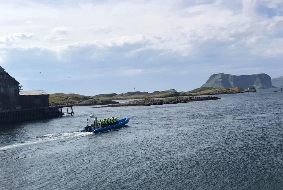
  • The trip departs from Røst Bryggehotell

    © Foto: Røst Rib

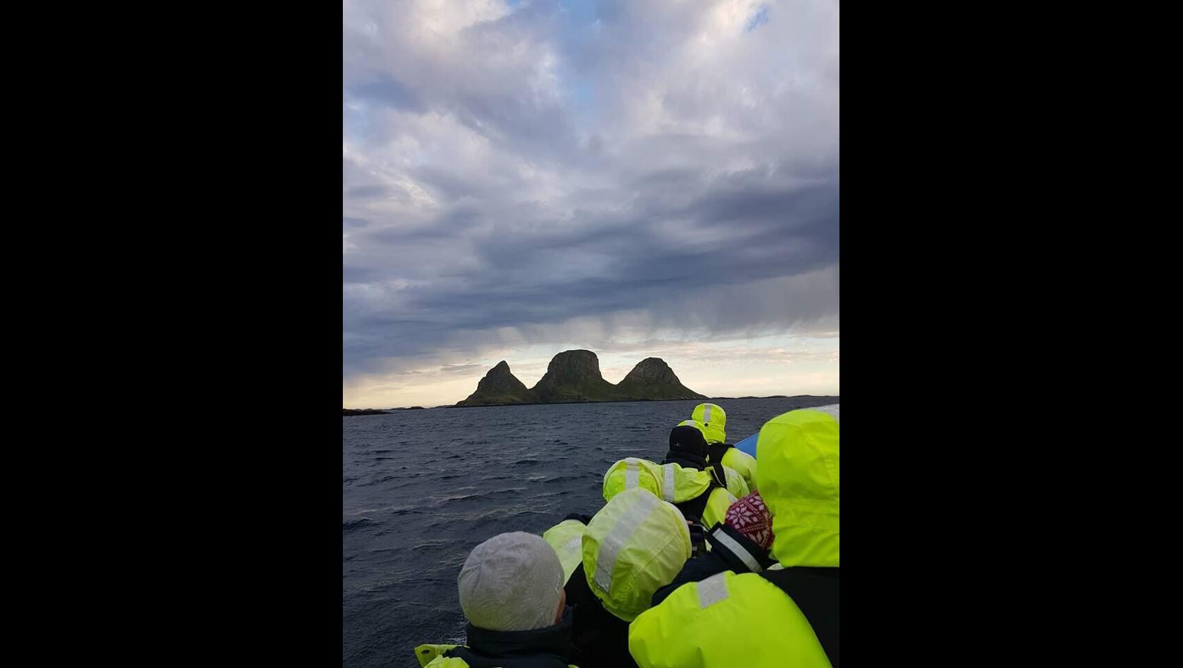
  • Experience Trenyken

    © Foto: Røst Rib

  • Season May – October

    © Foto: Røst Rib

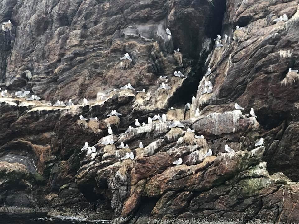
  • A rich birdlife

    © Foto: Røst Rib

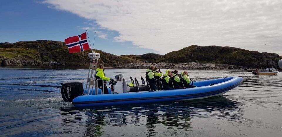
RIB tour with good stories and beautiful scenery with rich bird life

A wonderful experience from the sea around Røst. Experience Storfjellet, Trenyken and Skomvær lighthouse. Røst is known for teems with birds, You get to experience this close up since the boat has the opportunity to drive close to land where it otherwise is no access by road. The guide will share his good stories and facts.

You will be provided with thermo suits and lifejackets.

The trip lasts for two hours and departs from Røst Bryggehotell morning and afternoon every day during the summer season. Bookings also possible at other times. Season May – October.

For booking, please contact by phone or e-mail or book through Røst bryggehotell
The trip can be changed or canceled during bad weather.

Tyvsøyveien 2
8064 Røst

Telephone: +47 992 73 260
E-mail: tor-hen1@hotmail.com

https://www.facebook.com/RØST-RIB


Translation to English: www.lofoten.info